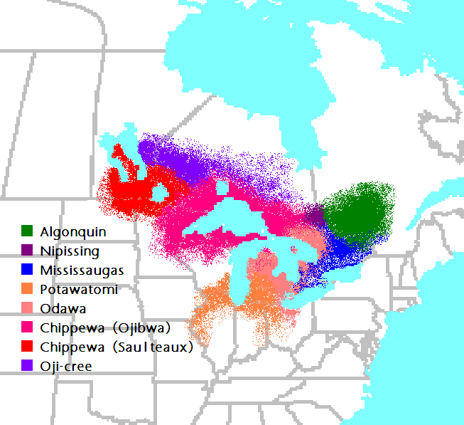
File:Anishinaabe-Anishinini Map.PNG
No higher resolution available.
Anishinaabe-Anishinini_Map.PNG (653 × 597 pixels, file size: 37 KB, MIME type: image/png)
Licensing
| This work has been released into the public domain by its author, CJLippert at English Wikipedia. This applies worldwide. In some countries this may not be legally possible; if so: CJLippert grants anyone the right to use this work for any purpose, without any conditions, unless such conditions are required by law. |
File history
Click on a date/time to view the file as it appeared at that time.
| Date/Time | Thumbnail | Dimensions | User | Comment | |
|---|---|---|---|---|---|
| current | 00:20, 5 January 2011 | | 653 × 597 (37 KB) | Dger | Fixed spelling of Saulteaux |
| 19:55, 11 June 2006 |  | 653 × 597 (42 KB) | Edulix~commonswiki | Imagen creada por el usuario en:User:CJLippert, liberado al dominio público y sacada de la Image:Anishinaabe-Anishinini_Map.PNG versión inglesa |
File usage
The following page uses this file:
Global file usage
The following other wikis use this file:
- Usage on br.wikipedia.org
- Usage on ca.wikipedia.org
- Usage on da.wikipedia.org
- Usage on de.wikipedia.org
- Usage on en.wikipedia.org
- Usage on eo.wikipedia.org
- Usage on es.wikipedia.org
- Usage on fr.wikipedia.org
- Usage on fr.wikinews.org
- Usage on gl.wikipedia.org
- Usage on hr.wikipedia.org
- Usage on it.wikipedia.org
- Usage on ja.wikipedia.org
- Usage on lv.wikipedia.org
- Usage on nn.wikipedia.org
- Usage on no.wikipedia.org
- Usage on pt.wikipedia.org
- Usage on ru.wikipedia.org
- Usage on sh.wikipedia.org
- Usage on sv.wikipedia.org
- Usage on tr.wikipedia.org
- Usage on uk.wikipedia.org
- Usage on zh.wikipedia.org